Lesson Plan #3 - How are Maps Different?
I. Objectives
Virginia SOL Standard
2.6 (Social Studies) The student will demonstrate map skills by constructing simple maps, using title, map legend, and compass rose.
2.11 (Writing) The student will write stories, letters, and simple explanations.
a) Generate ideas before writing
b) Organize writing to include a beginning, middle, and end
NCSS Theme: People Places and Environments, Individual Development & Identity, Global Connections
SWBAT Objective
· Student will be able to recognize why maps are important
· Students will recognize that a map shows a pictorial representation of a place and that different maps are used for various reasons
Essential Questions:
What is included when making a map?
What are important features of maps?
II. Materials for Learning Activities
· Teacher will need: Book - Pen/Marker, White Board, SMART board (to display maps), exploration worksheets, map of continents/oceans, local map, weather map (various maps), website link to map (http://exploringancientchina.weebly.com)
· Students will need: Social studies journal, pencil/crayons/markers, glue, worksheets
III. Procedures for Learning Activities
Introduction (5-7 minutes)
1. Teacher will gather students for whole group instruction on rug. Teacher will remind students that maps are tools that geographers use to study the Earth in an organized and helpful way. Question: Review from yesterday. Who can remember some ways that maps help us? Students will be given 30 seconds to turn and talk with their elbow partner to answer question. Teacher will call on a few students to give their responses and take note of students remembering previous lesson/using map terminology.
2. Teacher will share various forms of maps. Teacher will hold up a globe and explain that a globe is not the Earth and it is not a map but it is the most accurate representation of the Earth. Teacher will also explain that since we cannot carry around globes, maps are one of the best tools we can use to learn more about our Earth and the area we live in. Teacher will share link (see web link in materials).
Instructional strategies (15-20 minutes)
1. Introduction to lesson activity will be given as stated above. Teacher will ask students how can maps can different? What kind of maps have you seen? Teacher will share maps that show similar representations of the same place. Students will be asked to name map features they have learned.
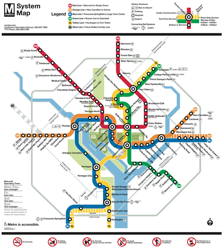
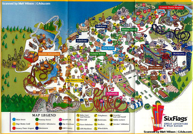
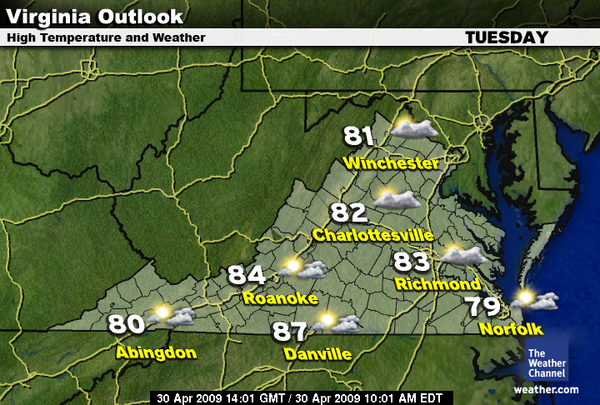
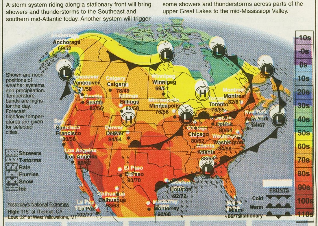
2. Students will be instructed that today they will be rotating in groups to different centers. Students will be instructed to take notes and make observations of the different maps they will examine. (Students will notice differences and similarities of different maps) Maps can include: Map of world continents and oceans, map of temperatures, map of six flags theme park, metro map. Students will have to look at the map at their station and fill out worksheet which will be glued in social studies journal. Students will have to make observations of how the maps are different and how they are similar. They will make observations of the different features of the map (see activity worksheet)
3. Students will be given opportunity to ask questions about activity and then be divided into groups for the different stations. Students will rotate room, looking at different maps and making observations. Teacher will circulate classroom to make sure students are focused and working. Teacher will observe and take anecdotal notes. Teacher will assist students if necessary.
4. Questions that teacher can ask if students need guidance: What are the features included in this map? What is the purpose of this map? When would you use this map? When can we use this map?
Summary (3-5 minutes)
1. Teacher will ask students to come to rug for closure when students have visited last station. Teacher will ask students to think about differences and similarities between the different maps. Students will turn and talk to discuss their written observations. Teacher will make list of student responses about features, similarities, and differences (looking for title, compass rose, map legend/key, labels, scale). 2. Optional: Exit Ticket can be given at this time: Describe one new aspect of maps that you learned today? How does a scale help us to read a map? (Extension for future lesson - math lesson)
IV. Assessment
Formative:
Teacher will take notes of any misconceptions during activity. Teacher will check for understanding through observation and anecdotal notes. Teacher will ask for questions or comments related to mapping worksheets.
Teacher will have student's social studies journal to check for their exploration and reflections for understanding of concept to assess for objectives. Optional: Teacher can make short exit ticket for students to assess whether students recognize various maps and their purpose.
V. Differentiation and Accommodations
Differentiation
· This lesson plan appeals to visual learners who are able to view the maps on the SMART board as well as examples of maps (hand-outs) - Auditory learners (teacher explanations) kinesthetic learners (activity worksheet). It can be adapted to emphasize one learning style or another depending on the students in the class.
Accommodations
· Students who need extra help with the activity can work with partners rather than individually. Teacher can read directions to students step-by-step (ample opportunity for scaffolding). Teacher may rotate and work directly with group of students who are in need of additional assistance or guidance. Teacher may also include differentiated map materials by using technology or print resources.
VI. Technology
SMART board will be used to project map and laptops may be used to assist students in finding various maps (weather, state, country, location maps, etc.).
Virginia SOL Standard
2.6 (Social Studies) The student will demonstrate map skills by constructing simple maps, using title, map legend, and compass rose.
2.11 (Writing) The student will write stories, letters, and simple explanations.
a) Generate ideas before writing
b) Organize writing to include a beginning, middle, and end
NCSS Theme: People Places and Environments, Individual Development & Identity, Global Connections
SWBAT Objective
· Student will be able to recognize why maps are important
· Students will recognize that a map shows a pictorial representation of a place and that different maps are used for various reasons
Essential Questions:
What is included when making a map?
What are important features of maps?
II. Materials for Learning Activities
· Teacher will need: Book - Pen/Marker, White Board, SMART board (to display maps), exploration worksheets, map of continents/oceans, local map, weather map (various maps), website link to map (http://exploringancientchina.weebly.com)
· Students will need: Social studies journal, pencil/crayons/markers, glue, worksheets
III. Procedures for Learning Activities
Introduction (5-7 minutes)
1. Teacher will gather students for whole group instruction on rug. Teacher will remind students that maps are tools that geographers use to study the Earth in an organized and helpful way. Question: Review from yesterday. Who can remember some ways that maps help us? Students will be given 30 seconds to turn and talk with their elbow partner to answer question. Teacher will call on a few students to give their responses and take note of students remembering previous lesson/using map terminology.
2. Teacher will share various forms of maps. Teacher will hold up a globe and explain that a globe is not the Earth and it is not a map but it is the most accurate representation of the Earth. Teacher will also explain that since we cannot carry around globes, maps are one of the best tools we can use to learn more about our Earth and the area we live in. Teacher will share link (see web link in materials).
Instructional strategies (15-20 minutes)
1. Introduction to lesson activity will be given as stated above. Teacher will ask students how can maps can different? What kind of maps have you seen? Teacher will share maps that show similar representations of the same place. Students will be asked to name map features they have learned.
2. Students will be instructed that today they will be rotating in groups to different centers. Students will be instructed to take notes and make observations of the different maps they will examine. (Students will notice differences and similarities of different maps) Maps can include: Map of world continents and oceans, map of temperatures, map of six flags theme park, metro map. Students will have to look at the map at their station and fill out worksheet which will be glued in social studies journal. Students will have to make observations of how the maps are different and how they are similar. They will make observations of the different features of the map (see activity worksheet)
3. Students will be given opportunity to ask questions about activity and then be divided into groups for the different stations. Students will rotate room, looking at different maps and making observations. Teacher will circulate classroom to make sure students are focused and working. Teacher will observe and take anecdotal notes. Teacher will assist students if necessary.
4. Questions that teacher can ask if students need guidance: What are the features included in this map? What is the purpose of this map? When would you use this map? When can we use this map?
Summary (3-5 minutes)
1. Teacher will ask students to come to rug for closure when students have visited last station. Teacher will ask students to think about differences and similarities between the different maps. Students will turn and talk to discuss their written observations. Teacher will make list of student responses about features, similarities, and differences (looking for title, compass rose, map legend/key, labels, scale). 2. Optional: Exit Ticket can be given at this time: Describe one new aspect of maps that you learned today? How does a scale help us to read a map? (Extension for future lesson - math lesson)
IV. Assessment
Formative:
Teacher will take notes of any misconceptions during activity. Teacher will check for understanding through observation and anecdotal notes. Teacher will ask for questions or comments related to mapping worksheets.
Teacher will have student's social studies journal to check for their exploration and reflections for understanding of concept to assess for objectives. Optional: Teacher can make short exit ticket for students to assess whether students recognize various maps and their purpose.
V. Differentiation and Accommodations
Differentiation
· This lesson plan appeals to visual learners who are able to view the maps on the SMART board as well as examples of maps (hand-outs) - Auditory learners (teacher explanations) kinesthetic learners (activity worksheet). It can be adapted to emphasize one learning style or another depending on the students in the class.
Accommodations
· Students who need extra help with the activity can work with partners rather than individually. Teacher can read directions to students step-by-step (ample opportunity for scaffolding). Teacher may rotate and work directly with group of students who are in need of additional assistance or guidance. Teacher may also include differentiated map materials by using technology or print resources.
VI. Technology
SMART board will be used to project map and laptops may be used to assist students in finding various maps (weather, state, country, location maps, etc.).
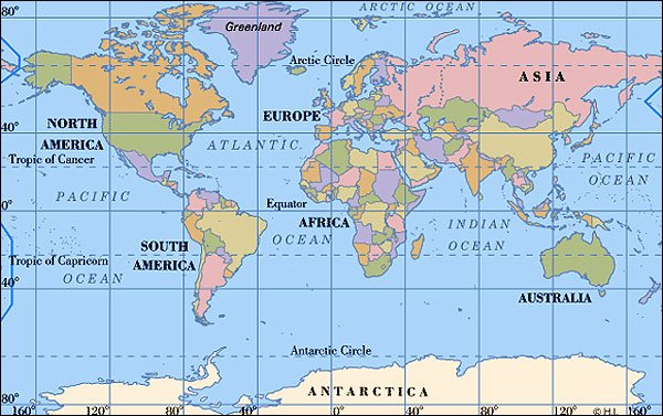
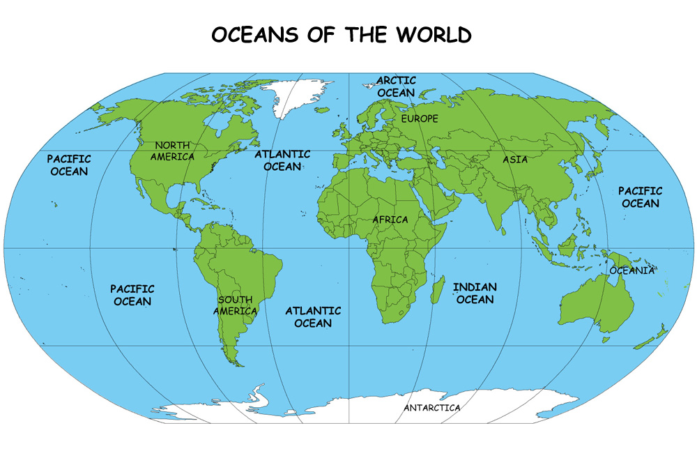
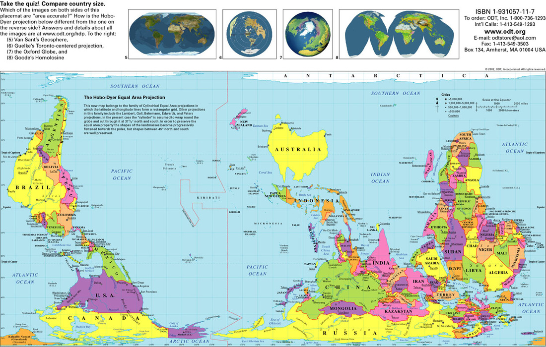
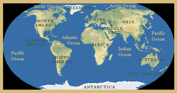
Examples of Maps that can be used for activity